Homestead to Miami: The Roads and Transit From Aria Park
In this article
"To get from Homestead to Miami, most people use one of three routes: Florida's Turnpike, U.S. 1 (South Dixie Highway), or the new Metro Express bus line that runs from the SW 344th Street Park-and-Ride to Dadeland South Metrorail Station. Aria Park sits on Palm Drive in Homestead, and Palm Drive is also called SW 344th Street. We do not give drive times, because traffic changes them every day. What we can give you are the real road names and how they connect, so you can test the trip yourself at the hour you would drive it.

Where Aria Park sits on the map
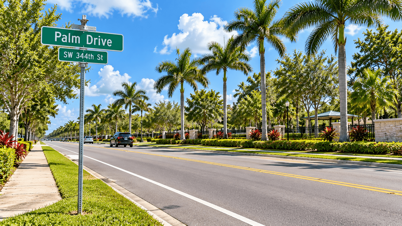
Lennar lists Aria Park at Palm Drive and 167th Avenue in Homestead. Palm Drive is State Road 9336, and it is also called SW 344th Street. The National Park Service uses both names when it gives directions to Everglades National Park, so you may see either one on signs and maps.
Palm Drive is a key road in this part of the county. It connects U.S. 1 in Florida City to the entrance of Everglades National Park. It also crosses Krome Avenue.
Route 1: Florida's Turnpike
Florida's Turnpike has a branch called the Homestead Extension, also numbered State Road 821. It runs north through Miami-Dade County, and its southern end is at U.S. 1 in Florida City. The National Park Service gives these directions for the park: take the Turnpike south until it ends, where it merges with U.S. 1 at Florida City, then turn right at the first traffic light onto Palm Drive.
The Turnpike's own map lists exits along the way. These include U.S. 1 at the south end, Campbell Drive (SW 312th Street), Biscayne Drive (SW 288th Street), Tallahassee Road (SW 137th Avenue) and Allapattah Road (SW 112th Avenue). Exit lists and tolls can change, so check the Florida's Turnpike website before you plan a trip.
The Turnpike is a toll road. If you will use it often, look up how tolls work on the Turnpike site before you decide which route is your main one.

Route 2: U.S. 1 (South Dixie Highway)
U.S. 1 is the old main road. It runs through Florida City and Homestead and goes north toward Miami. It also keeps going south to the Florida Keys. The Florida Keys Outlet Marketplace, which is on Palm Drive, tells visitors coming from the Keys to take U.S. 1 north to Palm Drive.
U.S. 1 has many traffic lights and stores along it. That makes it a road you can use for errands as well as for trips.
Route 3: Metro Express bus rapid transit
Miami-Dade County runs a bus rapid transit service called Metro Express along the South Dade TransitWay. The county says it runs between the SW 344th Street Park-and-Ride and the Dadeland South Metrorail Station, with 14 new stations. The county describes the buses as all-electric. It says the stations have level boarding, real-time arrival displays and free Wi-Fi.
Dadeland South is where the line meets Metrorail, Miami-Dade's rail system. You can read the county's overview on the Metro Express bus rapid transit page.
We do not know the schedule or the fare, and both can change. Check the county's page for current routes. If you plan to use transit, ask the sales team about the nearest stop to the home you pick.
Krome Avenue
Krome Avenue is the main north-south street through Homestead. It is also SW 177th Avenue, and it was State Road 997. Downtown Homestead sits on it, and so do Losner Park (104 N. Krome Avenue) and Homestead Station (4 S. Krome Avenue). Read our downtown Homestead guide to see what is there.
Krome Avenue has work zones and closures from time to time. If you drive it, check conditions before you go.
Campbell Drive
Campbell Drive (SW 312th Street) is a main east-west road in Homestead. Florida's Turnpike map shows it meeting the Turnpike at Exit 2. It is also where State Road 997, which is Krome Avenue, begins. That makes it a good road to know when you want to go between the Turnpike and downtown.
If you want a break from the road, Cauley Square: A Visitor's Guide From Aria Park covers a historic village that makes an easy stop.
How to test your own trip
A drive time on a blog is a guess. Your trip is real. Here is how to test it:
Pick the trip you will make most. For example, to work, to school or to a family member's house.
Drive it at that hour. Do it on a weekday at the real time of day, not on a Sunday morning.
Try the other route. Compare the Turnpike and U.S. 1. See which one feels better.
Try the bus if it fits. Look up the stop and the schedule.
Write it down. Compare notes after you visit more than one community.

Why a road name beats a number
Say a website tells you a trip takes a set number of minutes. That number came from one driver, on one day, at one hour. Your day will look different. A road name, on the other hand, does not change. When you know that Palm Drive meets Krome Avenue, and that the Turnpike ends at U.S. 1, you can open any map and plan the trip your own way.
That is also why we point you to the county and state sites for anything that changes, such as tolls, bus schedules and fares. They keep those up to date. We cannot.
Things we leave out on purpose
You may notice this guide has no minutes and no miles. That is on purpose. Traffic, tolls, work zones and weather all change the numbers, and they are not the same for everyone. A road name stays true. A minute count does not.
Putting it together
If you want to see what Homestead offers once you arrive, read about parks in Homestead and downtown Homestead. To learn about the homes themselves, start with our guide to Aria Park floor plans. And if you are curious about flood maps and insurance, read What Is a Flood Zone? A Homestead, FL Buyer's Guide.
Common Questions
What is the best way to get from Homestead to Miami?
It depends on your trip. Many people use Florida's Turnpike or U.S. 1. There is also a Metro Express bus line from the SW 344th Street Park-and-Ride to Dadeland South Metrorail Station. Test each route at the hour you would travel.
What road is Aria Park on?
Lennar lists Aria Park at Palm Drive and 167th Avenue in Homestead. Palm Drive is State Road 9336 and is also called SW 344th Street. It runs from U.S. 1 in Florida City to the Everglades National Park entrance.
Does Florida's Turnpike reach Homestead?
Yes. The Homestead Extension of Florida's Turnpike ends at U.S. 1 in Florida City. The National Park Service says to turn right at the first light onto Palm Drive to reach Everglades National Park. Check the Turnpike website for exits and tolls.
Is there public transit from Homestead to Miami?
Yes. Miami-Dade County's Metro Express bus rapid transit runs between the SW 344th Street Park-and-Ride and Dadeland South Metrorail Station, with stations along the way. Check the county page for current routes, schedules and fares.
What is Krome Avenue?
Krome Avenue is the main north-south street through Homestead. It is also SW 177th Avenue and was State Road 997. Downtown Homestead sits on it. It crosses Palm Drive, so you may use it to reach Aria Park.
How long is the drive from Aria Park to Miami?
We do not publish drive times, because traffic, tolls and work zones change them every day. Drive the trip yourself on a weekday at the hour you would really go. That gives you a number that is true for you.
Want to drive it with us? Call 561-704-0091 or Test the Drive From Aria Park — Schedule a Visit. We can show you the roads and the nearest bus stop.
Related reading: Downtown Homestead FL: A Guide From Aria Park, Cauley Square: A Visitor's Guide From Aria Park, Parks in Homestead FL: A Guide From Aria Park, What Is a Flood Zone? A Homestead, FL Buyer's Guide, and the Aria Park community page."