Florida's Turnpike and the Roads Around Coral Breeze
In this article
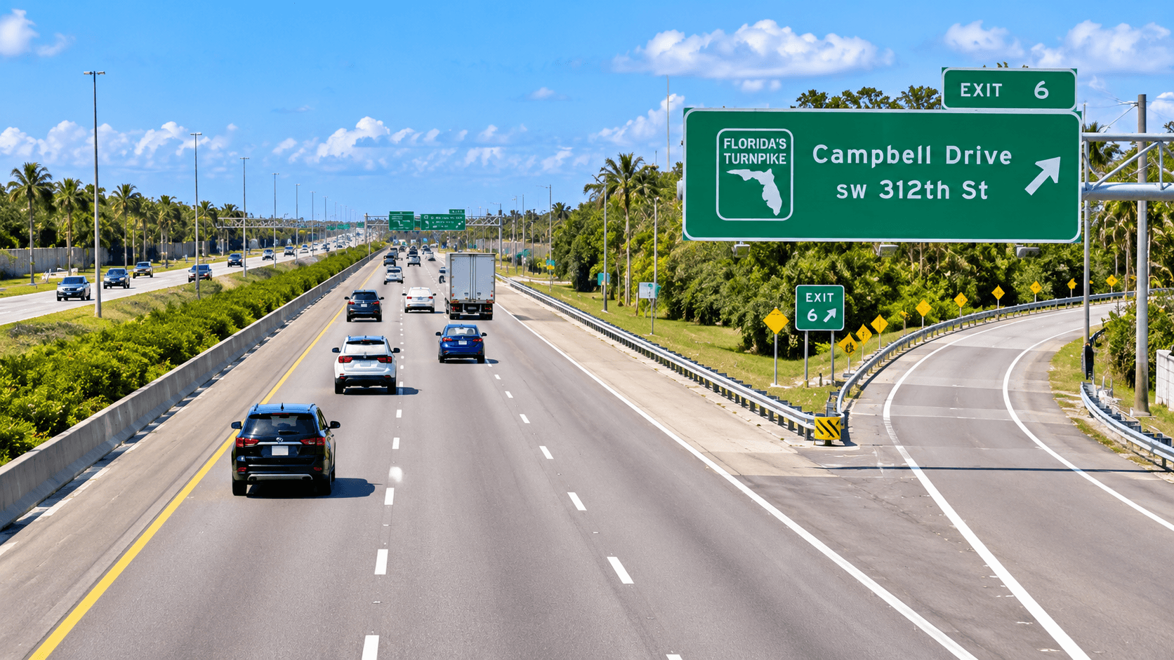
Florida's Turnpike is a toll road, and its south end meets U.S. 1 near Homestead. For Coral Breeze, the closest Turnpike exit is Exit 2, Campbell Drive, which is SW 312th Street. Coral Breeze sits on SW 192nd Avenue, just south of SW 312th Street. This guide names each road you will use, so you can learn the area before you visit. We do not give drive times, because traffic changes. Use a live map app on the day you travel.
Florida's Turnpike Near Coral Breeze: The Exits
The Turnpike's own South Florida map lists these exits at the south end of the road, from south to north:
Exit | Name on the Turnpike map |
|---|---|
0 | U.S. 1 (S. Dixie Hwy.) |
2 | Campbell Dr. (SW 312th St.) |
5 | Biscayne Dr. (SW 288th St.) |
6 | Tallahassee Rd. (SW 137th Ave.) |
9 | Allapattah Rd. (SW 112th Ave.) |
North of Exit 9, the map shows the Homestead Plaza at marker 10. The map marks that plaza as "Toll Plaza (All-Electronic)". That means there are no cash lanes. Check Florida's Turnpike for how tolls are paid and current rates.
The Turnpike's South Florida toll-rate sheet labels this road "Turnpike Mainline (SR 821)". So you may also see it called State Road 821 on maps.

Exit 2: Campbell Drive (SW 312th Street)
Campbell Drive is the name the Turnpike uses for SW 312th Street. It is the street just north of Coral Breeze. Miami-Dade County's street map shows SW 192nd Avenue meeting SW 312th Street right at the community. SW 192nd Avenue runs south from there, past the Coral Breeze homes.
So Exit 2 is on the same street that runs along the north side of Coral Breeze. Use a map app to pick the best way to the ramp.
Exit 0: Where the Turnpike Meets U.S. 1
At the south end, the Turnpike meets U.S. 1, which the Turnpike map calls S. Dixie Hwy. A Turnpike project page describes work on this area. It says, "The US 1 and Palm Drive intersection is located just south of the Florida's Turnpike/SR 821 southbound exit to US 1."
U.S. 1 is also the road south to the Florida Keys. Our turn-by-turn guide to driving from Homestead to Key West explains that route.
Krome Avenue (State Road 997)
Krome Avenue is the other big road near Coral Breeze. The Florida Department of Transportation names it "SR 997/SW 177 Avenue/Krome Avenue" in a project notice. So Krome Avenue, SW 177th Avenue and State Road 997 are the same road.
Krome Avenue runs north and south. County map data places SW 177th Avenue east of Coral Breeze. The City of Homestead lists Krome Avenue projects in its downtown plans. To learn more about it, read our Krome Avenue road guide.
SW 192nd Avenue
SW 192nd Avenue is the street Coral Breeze faces. The homesite addresses Lennar shows for Coral Breeze are on SW 192nd Avenue. Miami-Dade County's map data lists this stretch as part of unincorporated Miami-Dade, not the City of Homestead.
U.S. 1 and the Bus Rapid Transit Line
If you would rather take a bus, Miami-Dade County runs a bus rapid transit line in the area. The county says the "Metro Express Bus Rapid Transit connection from Homestead to Dadeland South is now in service." It also says the corridor "runs 20 miles in length".
Our guide to roads and transit from Homestead to Miami covers the busway and the Turnpike in more detail.

The Other Turnpike Exits Near Homestead
The Turnpike map lists these exits north of Exit 2:
Exit 5, Biscayne Dr. (SW 288th St.)
Exit 6, Tallahassee Rd. (SW 137th Ave.)
Exit 9, Allapattah Rd. (SW 112th Ave.): the last exit before the Homestead Plaza on the map.
Each exit uses two names. The Turnpike map gives the local name and the county grid name, like Biscayne Dr. and SW 288th St. Learning both will help when your map app switches between them.
Work Near the South End of the Turnpike
The Turnpike has a project at its south end. Its project page says, "The project begins at US 1/State Road 5 and SW 352nd Street to the south in Florida City and extends north along US 1 to Davis Parkway and along Florida's Turnpike/SR 821 north to near Milepost 1 in Homestead." If you will use Exit 0 often, check the project page for lane changes.
FDOT also does work on Krome Avenue from time to time. One FDOT notice describes "the next segment of the SR 997/SW 177 Avenue/Krome Avenue Landscape Project". Road work is normal here, so check FDOT news before a big trip.
Places You Might Go, by Road
Here is how the main roads connect to places Lennar names near Coral Breeze:
South Dade Park: northeast of Coral Breeze, on SW 164th Avenue. See our South Dade Park guide.
Downtown Homestead: along Krome Avenue, east of Coral Breeze.
The Florida Keys: south on U.S. 1.
Miami: north on the Turnpike from Exit 2.
A Quick Road Glossary
SR 821: Florida's Turnpike.
SR 997: Krome Avenue, also SW 177th Avenue.
U.S. 1: S. Dixie Highway, also State Road 5.
Campbell Drive: SW 312th Street.
Homestead Plaza: the all-electronic toll plaza at marker 10 on the Turnpike map.
Metro Express: the county's bus rapid transit line from Homestead to Dadeland South.
How This Fits Into Your Home Search
Roads are one reason people pick Coral Breeze. The Turnpike is close, and so are Krome Avenue and U.S. 1. Lennar builds other communities in the area too, some closer to the Turnpike and some farther away. To compare them, read our side-by-side of Lennar communities around Homestead.
If you are new to the area, start with our Homestead FL guide. It explains the city, the county and the address question.
Tips for Learning the Roads
Drive it at rush hour. Visit once in the morning and once in the evening to see real traffic.
Set up your toll account. The Homestead Plaza is all-electronic.
Save the exits. Exit 2 is Campbell Drive. Exit 0 is U.S. 1.
Check road work. FDOT and the Turnpike post project news online.
Try the bus once. If you work near Dadeland, test the Metro Express line before you decide how you will commute.

Price at Coral Breeze
Lennar's starting prices put the Solea twin homes at Coral Breeze in the high $400,000s. Call 561-704-0091 for today's numbers.
Common Questions
What is the closest Florida's Turnpike exit to Coral Breeze?
Exit 2, Campbell Drive, which is SW 312th Street. Coral Breeze sits on SW 192nd Avenue just south of SW 312th Street.
Where does Florida's Turnpike end in the south?
The Turnpike map shows Exit 0 at U.S. 1, also called S. Dixie Highway, near Palm Drive.
Is the Turnpike near Homestead all-electronic?
The Turnpike map marks the Homestead Plaza as an all-electronic toll plaza. Check Florida's Turnpike for payment options and rates.
Is Krome Avenue the same as SW 177th Avenue?
Yes. FDOT names it SR 997, SW 177 Avenue and Krome Avenue in one project notice.
Is there a bus from Homestead to Miami?
Miami-Dade County says a Metro Express bus rapid transit line runs from Homestead to Dadeland South. Check the county site for stops and times.
How long is the drive to Miami?
We do not give drive times, because traffic changes a lot. Use a live map app at the time you plan to travel.
See the Area for Yourself
The best way to judge the roads is to drive them. Call 561-704-0091 or book a Coral Breeze tour and drive the roads. You can also check the Coral Breeze location and homes.
Related reading: South Dade Park and Daily Life Near Coral Breeze · Homestead FL: A Buyer's Guide and Where Coral Breeze Fits · Lennar Homes Homestead FL: Coral Breeze and Its Neighbors Compared