Homestead to Key West: The Roads, Turn by Turn
In this article
To get from Homestead to Key West, you take U.S. 1 south through Florida City and onto the Overseas Highway, which hops island to island all the way to Key West. There is one other way onto the Keys from the mainland: Card Sound Road, a toll route that rejoins the islands in north Key Largo. For buyers looking at Terra Sol, Lennar's townhome community in Homestead, that means the Florida Keys are a day trip, not a vacation flight.
This guide covers the roads, turn by turn, plus planning tips for the drive. We name roads instead of drive times, because times change with traffic and weather.

Step 1: From Terra Sol to U.S. 1
Terra Sol sits at SW 172nd Avenue and SW 336th Street in Homestead, just east of Krome Avenue and a short way north of Palm Drive.
The simple route:
Head to Palm Drive, which is also SW 344th Street.
Go east on Palm Drive to U.S. 1 in Florida City.
Turn south on U.S. 1.
Florida City is the last town on the mainland. It is the place to fill your tank and grab supplies before the islands.
Step 2: Florida City to Key Largo
From Florida City you have two choices.
Option A: U.S. 1, the main route. Stay on U.S. 1 south. The road crosses the wetlands and water between the mainland and Key Largo. According to the Overseas Highway article on Wikipedia, this stretch was rebuilt in the 1940s along the old railroad route through Jewfish Creek.
Option B: Card Sound Road, the toll route. Card Sound Road, also called County Road 905A, starts at U.S. 1 in Florida City. It crosses Card Sound on a high toll bridge and ends at County Road 905 in north Key Largo. From there you follow the road back to U.S. 1. Wikipedia's Card Sound Road article says tolls are collected electronically by license plate.
Card Sound Road and U.S. 1 are the only two road links between the mainland and the Florida Keys. Wikipedia also notes the Card Sound toll is waived during hurricane evacuations or when U.S. 1 cannot be used.

Step 3: Key Largo to Key West
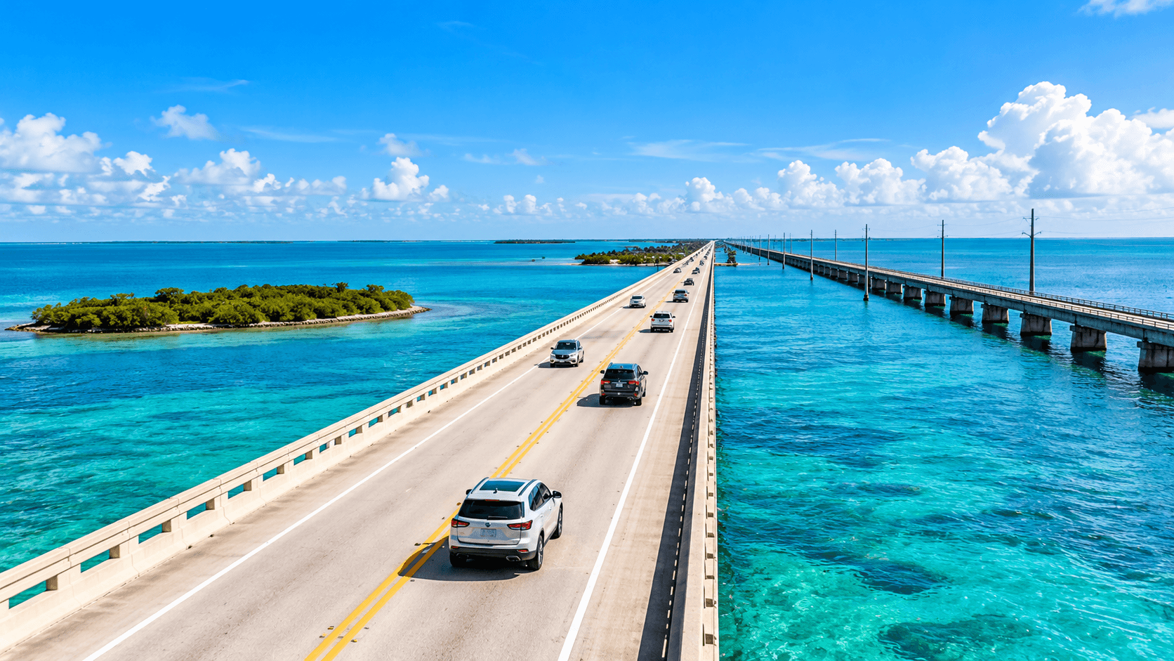
Once you are in Key Largo, it is one road the rest of the way: U.S. 1, the Overseas Highway. It runs over a long chain of islands and bridges until it reaches Key West.
A few things to know about this stretch:
Mile markers. Small green signs along the road count the miles. They start at 0 in Key West and go up as you head back toward the mainland. Keys businesses often give their address by mile marker, so watch for them.
The Seven Mile Bridge. This long bridge in the middle Keys is one of the most famous parts of the drive.
Few alternatives. On most of the route there is no second road. If there is a crash, traffic can stop. Leave extra time.
Changing speed limits. Speed limits change along the route, especially through the island towns. Watch the signs.
Coming from farther north
If friends are coming down from Broward or Palm Beach County, they usually use the Homestead Extension of Florida's Turnpike, also known as State Road 821. According to Wikipedia, it ends at U.S. 1 in Florida City, right where the Keys route begins. Toll information is on the Florida's Turnpike website.
Planning tips for the drive
Start early. Traffic on U.S. 1 is often heavier on weekends and holidays, and there is only one road for most of the trip.
Fill up in Florida City. It is the last mainland town before the islands, so it is the easy place to get gas and supplies.
Know the toll rules. If you take Card Sound Road, the toll is billed by plate.
Check the weather. Atlantic hurricane season runs from June 1 to November 30. Watch the forecast before you go.
Pack for sun. Water, sunscreen and a hat make stops more comfortable.
Plan your stops by mile marker. It is the easiest way to find places along the way.
For trip ideas and current information, see the official Florida Keys tourism website.
Day trip or weekend?
A day trip works well for the upper Keys. Key Largo is the first island on the route, so a morning on the water and lunch there makes an easy outing. You are only on the islands for the first part of the route, so it is a short commitment.
Key West is usually a weekend. It sits at the far end of the chain, past many bridges and islands. Driving down and back in one day leaves little time to enjoy it. Most people book a night or two.
Either way, plan around the road. Since U.S. 1 is the only route for most of the trip, one accident can slow everything. Leave early, keep your plans loose, and check traffic before you head home.
Before you go: a quick checklist
A full tank of gas from Florida City
Your toll account set up if you plan to use Card Sound Road
Sunscreen, water and a hat
A plan for where you will stop, by mile marker
The weather forecast, especially from June through November
Why it matters if you live in Homestead
Living in Homestead puts you at the doorstep of the Keys. A beach day, a fishing trip or a long weekend in Key West does not require a flight or a hotel near an airport. You drive south on U.S. 1.
It also works the other way. The Turnpike and U.S. 1 meet in Florida City, right next to Homestead, so getting north to the rest of Miami-Dade is straightforward too.
The farm country north of Homestead is close too. Read our Redland, FL guide and our Monkey Jungle guide for outings closer to home.
About Terra Sol
Terra Sol has four two-story townhome plans from about 1,649 to about 1,804 square feet, each with a one-car garage and a balcony off the owner's suite. See them all in our Terra Sol floor plans guide. Lennar's published feature list includes impact-resistant glass windows and doors, which matters in a hurricane region. Our solid surface countertops guide lists every included feature.

Common Questions
How do you drive from Homestead to Key West?
Take U.S. 1 south through Florida City and stay on it. It becomes the Overseas Highway and runs over the islands all the way to Key West. Card Sound Road is a toll alternative for the first stretch into Key Largo.
What is Card Sound Road?
Card Sound Road, County Road 905A, runs from U.S. 1 in Florida City to County Road 905 in north Key Largo. It crosses a high toll bridge, and tolls are collected by license plate.
How many roads go into the Florida Keys?
Two. U.S. 1 and Card Sound Road are the only two road links between the mainland and the Keys. Both leave the mainland from Florida City.
What are mile markers in the Keys?
They are small green signs that count miles along U.S. 1. They start at 0 in Key West and go up toward the mainland. Many Keys businesses give their address by mile marker.
Where does the Turnpike end?
The Homestead Extension of Florida's Turnpike ends at U.S. 1 in Florida City, right where the route into the Keys begins.
How long does the drive take?
We do not give drive times, because traffic, weather and stops change them a lot. Check a map app before you leave, and leave extra time on weekends and holidays.
Want to see what living this close to the Keys looks like? Call 561-704-0091 or See Terra Sol Homes in Homestead — Schedule a Visit.
Related reading: Redland, FL: Farm Country Near Terra Sol, Monkey Jungle: A Local's Guide, Terra Sol Floor Plans Compared, Solid Surface Countertops at Terra Sol, and the Terra Sol community page.